Oregon-bound Chapter 3: Mission Impossible: Oregon's Backcountry Discovery Route
May 11-15, 2017.
Day 1: Thursday, May 11.
Parting ways with Pops and my Uncle, our plan was to run the OBDR from Seneca, OR to Walla Walla, WA, and then the WABDR from the border up to Cle Elum - approximately 1000 miles of remote back roads in four days.
We knew it'd be a lot of driving, but we've driven a lot for other trips. We were sure we could do it - it's not like we'd be going 10 mph the whole time.
At least we were right about one thing. We definitely weren't going 10 mph the whole time. But now we're getting ahead of ourselves.
From Diamond Craters, we headed back to Burns where we stocked up on food and ice for the rest of the trip. We also stopped in at the ranger station to ask about snow pack and overall road conditions through the Malheur and Umatilla National Forests - where we'd be traveling on Forest Service roads for much of the trip. The rangers weren't sure, but they called a station to the north and the consensus was that we might encounter a snow drift or two at some of the higher elevations.
"Sounds like a fun trip," they said.
Boy, were they right. For all the wrong reasons.
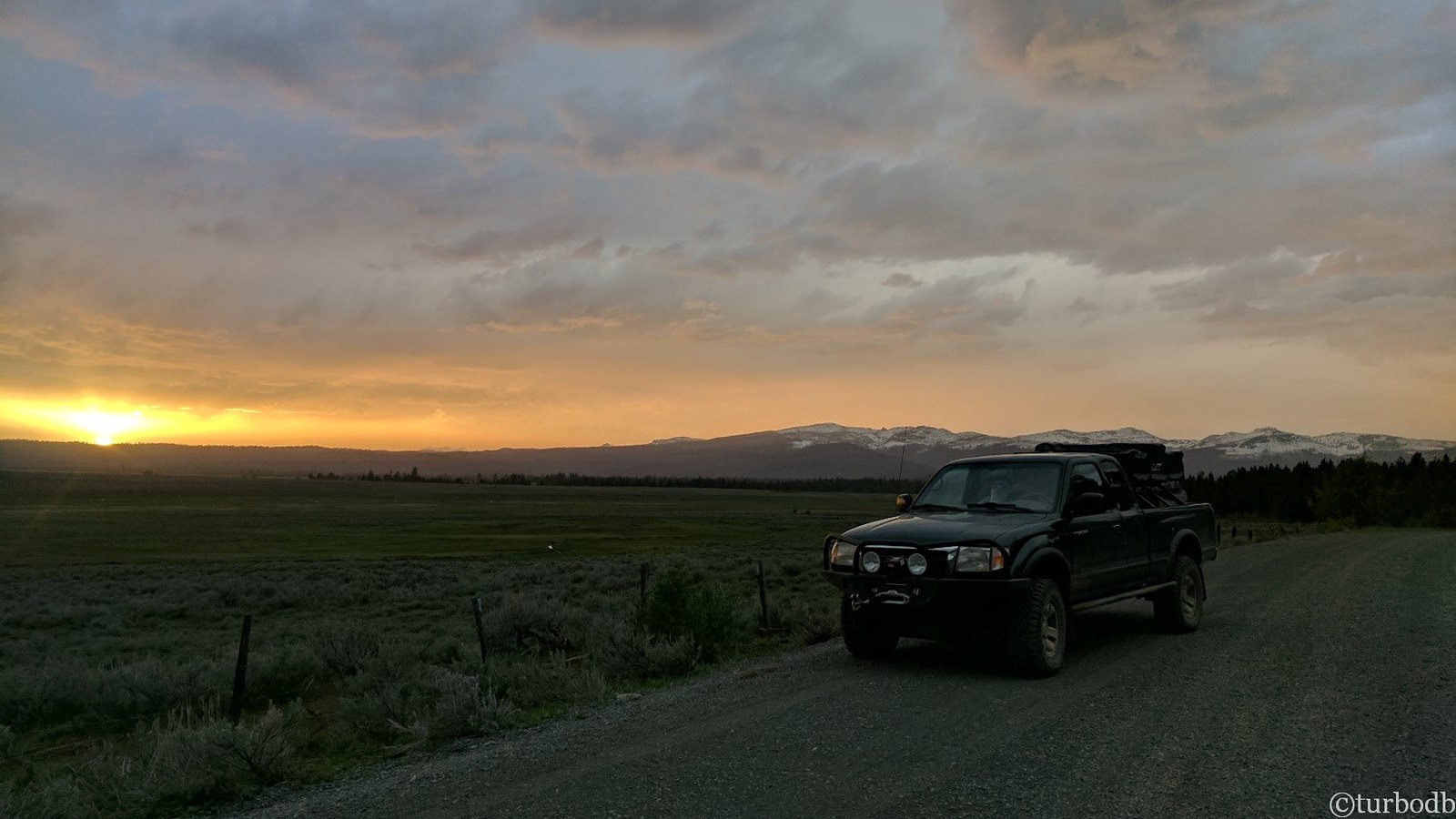
We headed up to Seneca, and joined the OBDR on FS-16 - ready for an adventure. The GPS was on, maps ready.
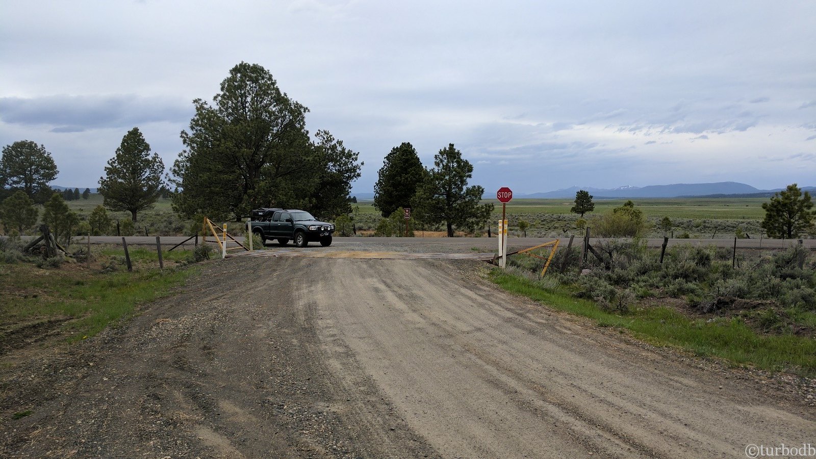
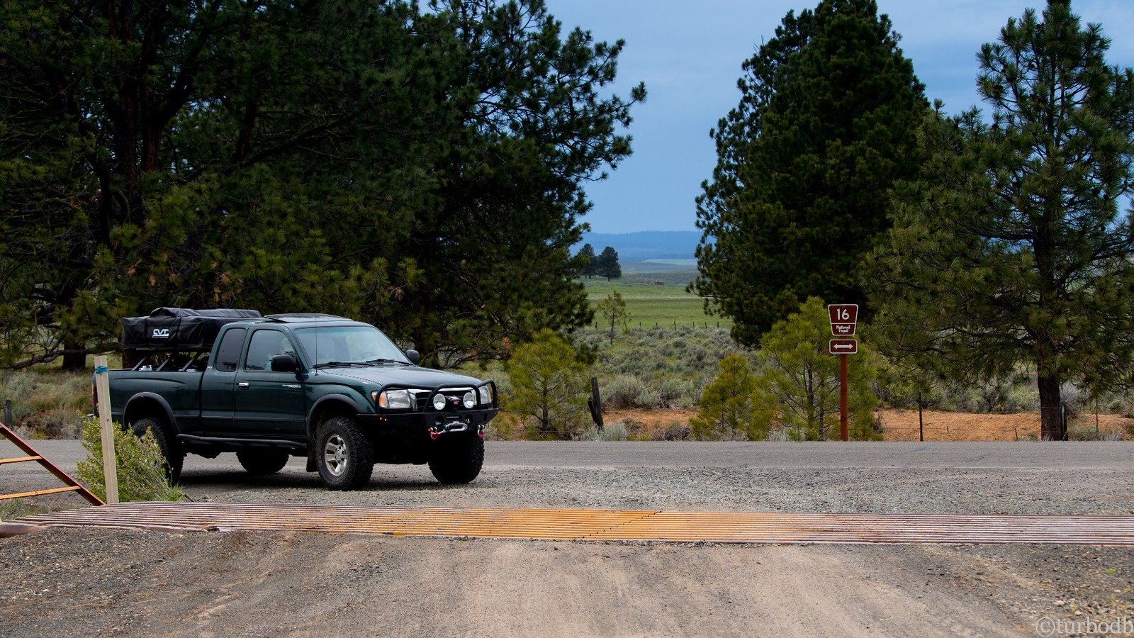
We cruised along for 18 minutes, getting a feel for the GPS track and enjoying the back roads.
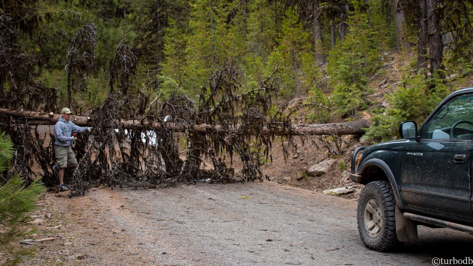
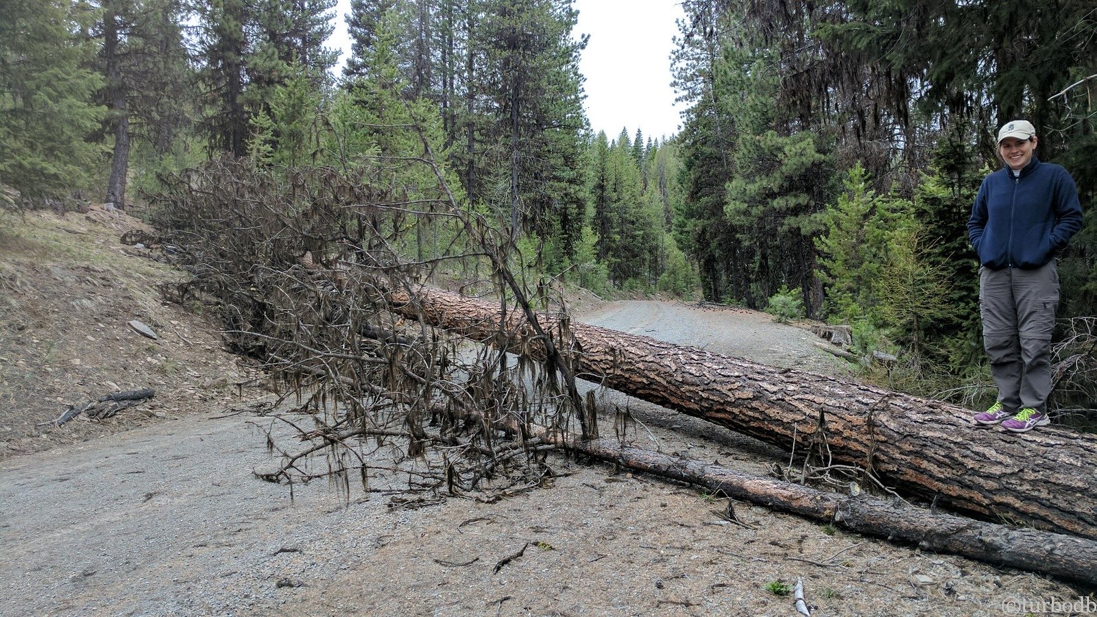
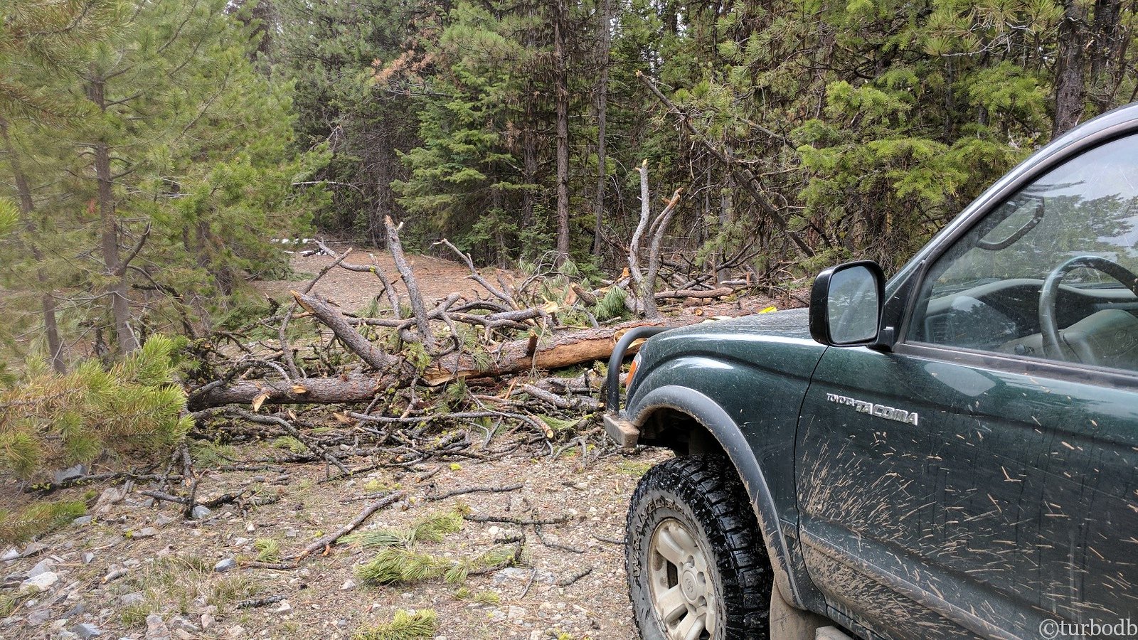
And then… our first tree. And it was a big one. Too big for my 10" Japanese pull saw.
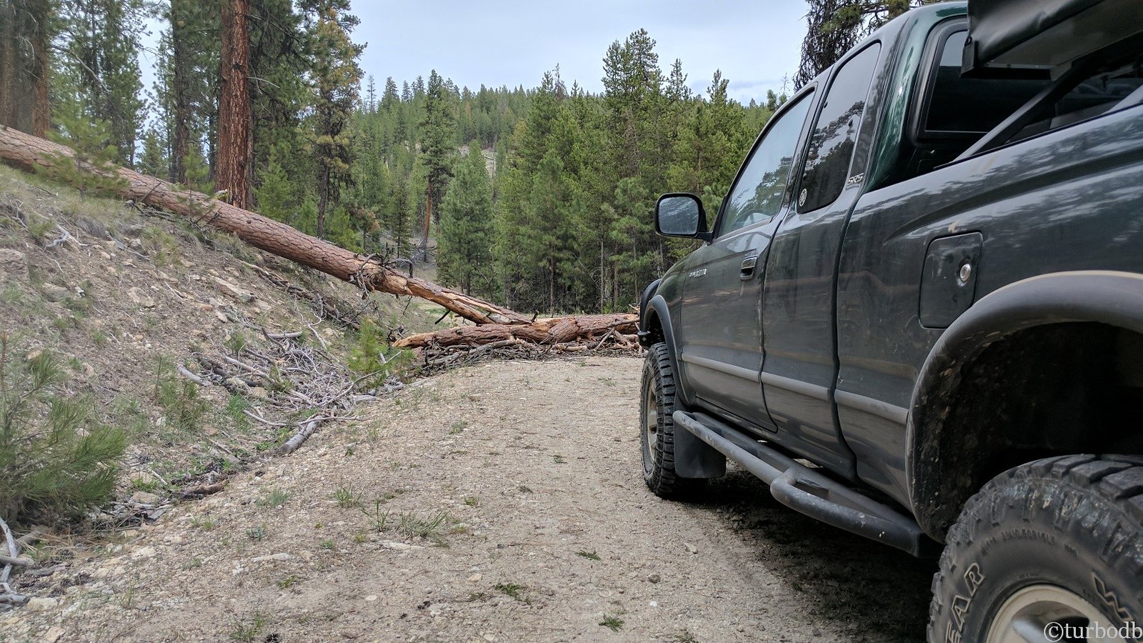
We stopped and got out to evaluate.
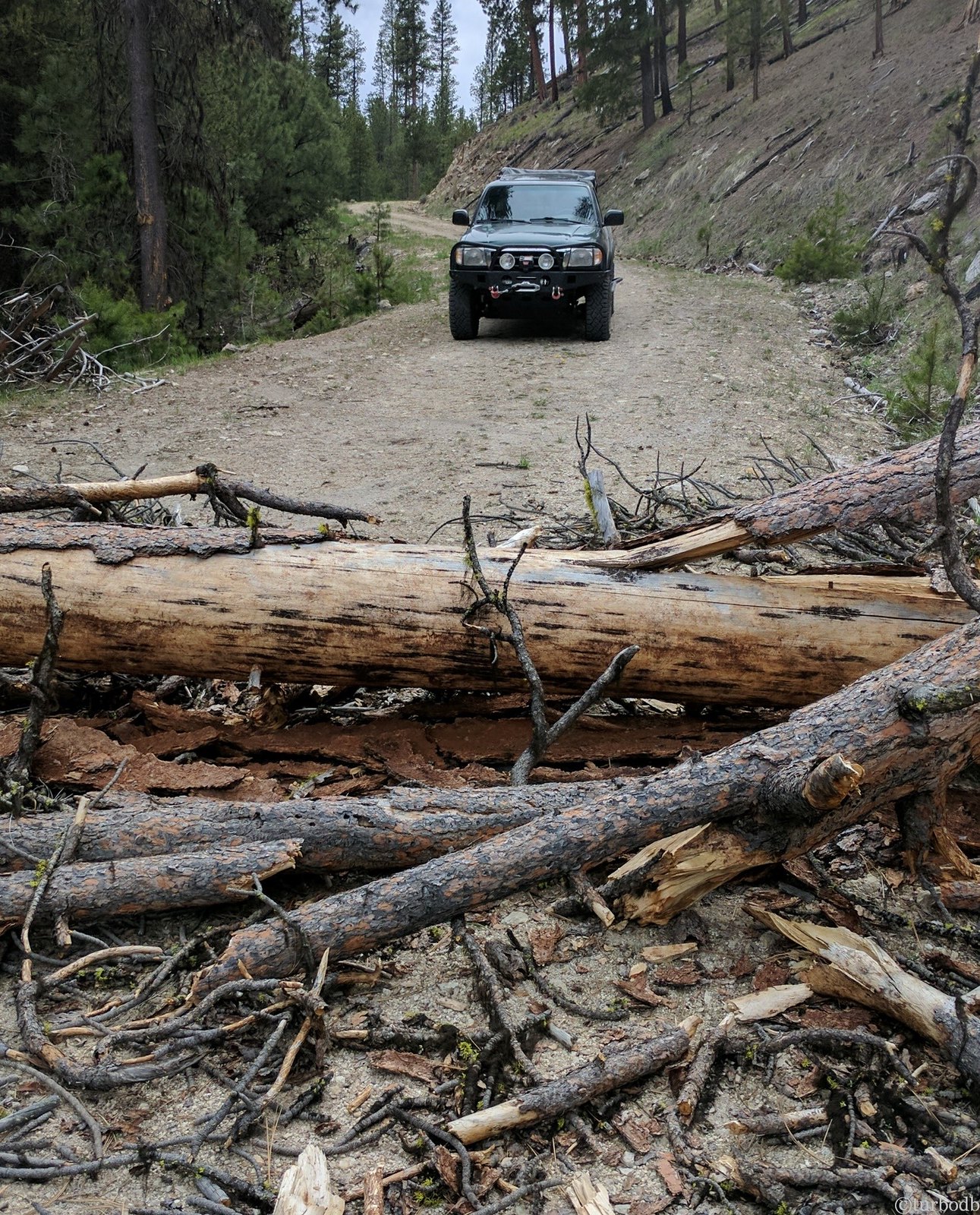
The main trunk was probably 12 to 14 inches in diameter, and there was a bunch of other debris on the road as well. The debris we could move, but without a chainsaw, were we going to be stuck looking for an alternate route, just 18 minutes into our trip?
No. No we weren’t. I had an idea.
Now, before I share the idea, I will warn you - it's not some groundbreaking idea. But I'd never had to do it before. Which looking back now is sort of shocking…
…so the idea: grab a tow strap, tree saver, and shackles, and pull the tree out of the way - at least enough to get by and keep going - we wanted to make it 60 or so miles to Unity (at least) before setting up camp for the night.
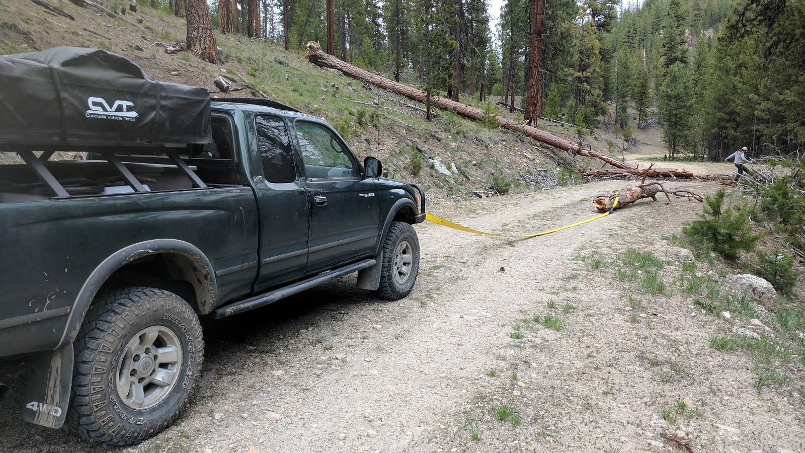
With the largest section of the tree moved, and @mrs.turbodb having taken out some of her frustration on the debris (you can see her kicking it out of the way above), we continued on, proud of ourselves for overcoming such an obstacle.
The thought never crossed our mind that we'd run into another downed tree.
I mean, it's not like we were doing this early in the season. Or that it had been the snowiest, rainiest winter and spring on record.
Of course, it should have dawned us when we hit that first tree - we were the first this year. And there had been lots of water. Both are facts that would become patently obvious to us in the coming days.
After another 15 minutes of driving, we decided it was time to air down. We should have done this first thing, but we were anxious to make good time. No one else around except the four elk that ran across the road in front of us, we stopped on the edge of their beautiful green meadow to let the air out of the tires.

Down to 18 psi, and man did the ride get better. It's like the best suspension upgrade you could ask for. We were immediately thankful for the new ARB compressor, again.
We continued on, making good time until we got to a fork in the GPS tracks. To the right, the OBDR continued. To the left, an offshoot to Frazier Point Fire Lookout.
We initially continued on the OBDR, but then decided that a fire lookout was probably worth it, so we backed up and headed to the left.
Where we nearly immediately ran into another downed tree. Hot off our last success, we hooked up the straps again and pulled it out of the way.
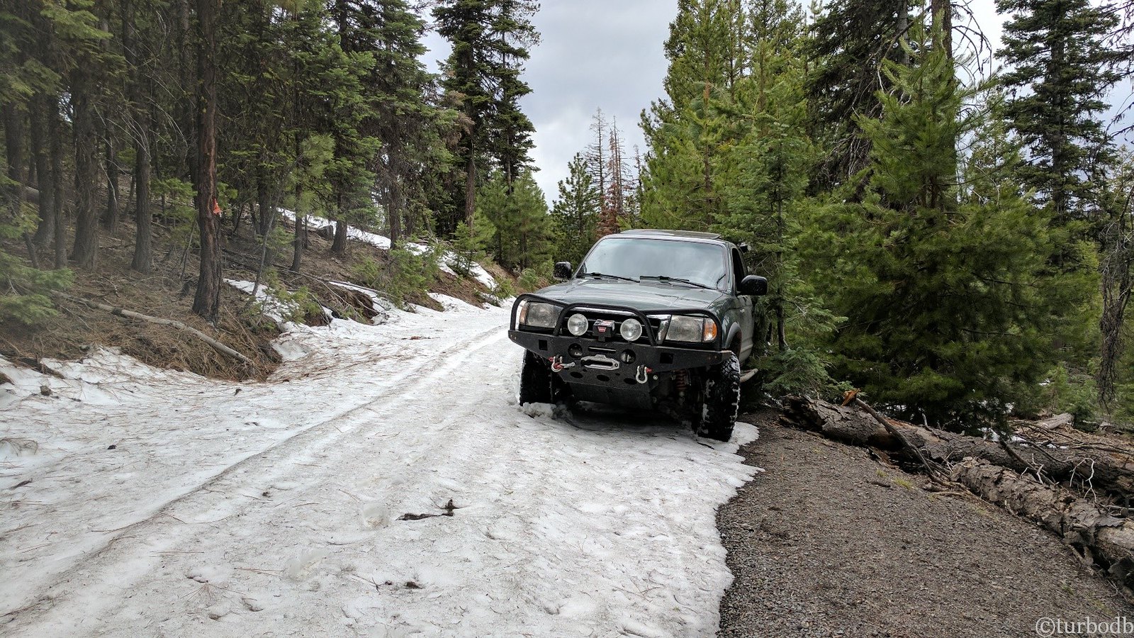
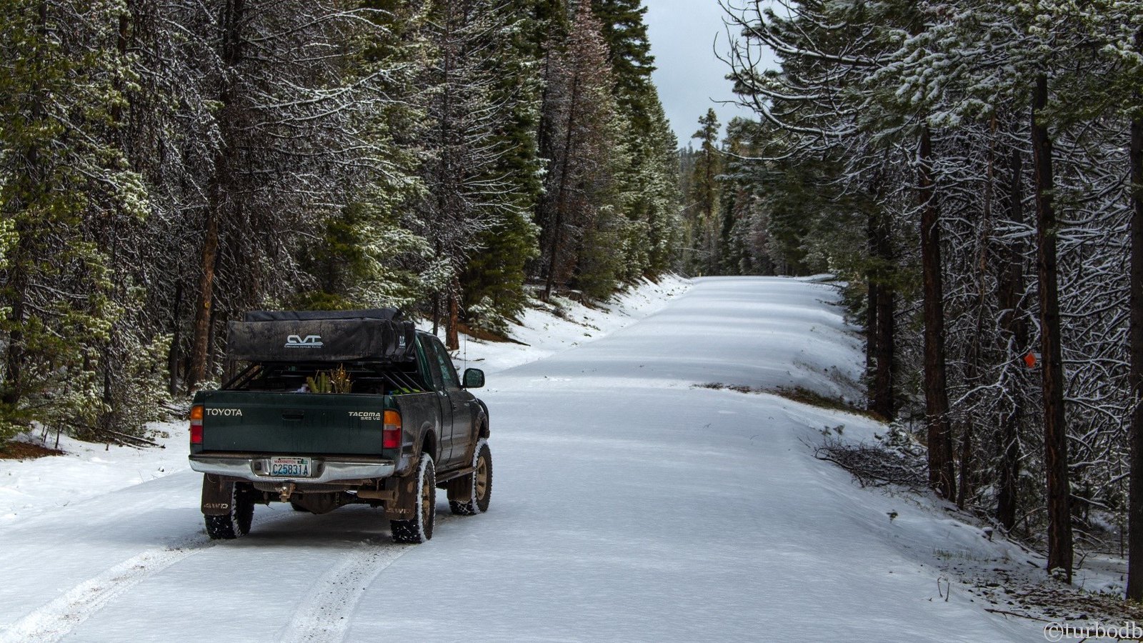
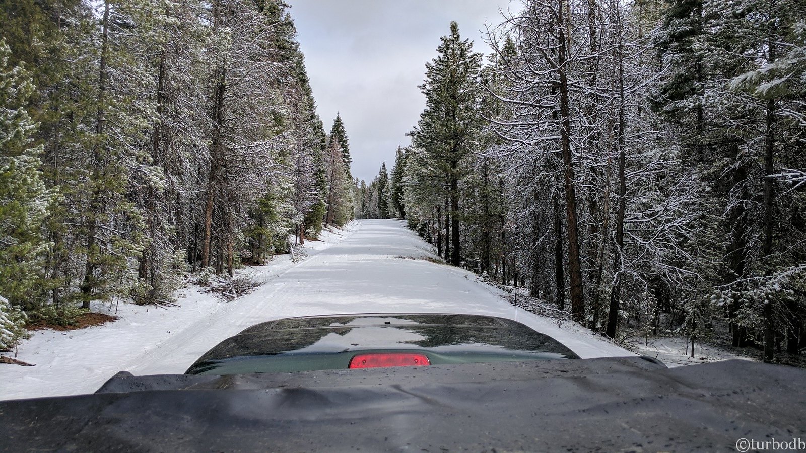
We continued on. Gaining elevation. Then, the snow started to appear. Not in the air, but on the ground. Small patches on the side of the road. Then, drifts on the road.
The first few drifts were easy to drive around, and then we got to one that covered most of the road. There was enough room to fit the driver side tires to be "mostly on road," but that was it - the passenger side would be in a foot of slushy, wet snow.
So I put it in low 4WD and locked the rear differential to try to maintain as much traction as possible.
It wasn't enough. We started sliding off the road. Down the side of the mountain.
I immediately got off the gas and exited the truck to evaluate the situation.
I'd gotten off the gas quickly enough that we hadn't slipped far. The small tree we were passing was inches from the slider. But there was no way forward, and no way backward, without making the situation worse.
At least, not using engine power.
So we broke out the tree saver again and unspooled the winch. We figured that we could slowly pull ourselves back up onto the road, and then re-evaluate the situation.
The self-recovery successful, we looked up the road to see larger and deeper drifts, and decided that Frazier Point Lookout wasn't in our future - it was back to the OBDR for us!

We continued on for another 45 minutes until we came upon the only other vehicle we'd see all trip - of course, another Tacoma (a 3rd Gen, Quicksand). They were stopped (to camp) on the bank of the Malheur River.
And it turned out that the OBDR continued on - through the river. A ford as it were. From "100 Hikes / Travel Guide: Eastern Oregon":
Malheur Ford really does have a ford - a frightening 50-foot crossing where high-clearance rigs sometimes plow across the river to continue on Road 1651. Fortunately, there's no need to try it because the trail starts on the near side.
The problem was, we needed to continue on. We were one afternoon, and less than 20 miles into our 1000-mile journey.
We exited the truck to evaluate the situation. And the mosquitoes attacked. We got back in the truck.
I decided that I'd wade across the river (which looked too deep and too fast for us to make it) to see if there was any chance that we could continue on. I strapped on the tree saver and hooked on the winch line - I'd hook those to a boulder on the other side "just in case" we started getting swept down the river.
As I waded across in just by boxer briefs, the water was "balls deep." It was cold. And it was fast.
@mrs.turbodb was visibly concerned.
I reached the other side just as the winch line ran out. I hooked the strap around the boulder and waded back. We jumped in the truck to discuss the situation. There were three problems as I saw it:
1. The water was deep - about 36 inches. That's right about at the top of the wheel well of the truck, pretty close to the air intake.
2. The water was moving fast - really fast. I'd had to use a pole (dead tree) to keep my balance as I'd waded across.
3. The winch was at its max extension and would be under water the entire crossing.
The decision was simple, but we didn't make it immediately. We discussed. And then @mrs.turbodb asked, "What's the worst that could happen."
"We could lose the truck," I said.
And with that, the decision was made. I would be wading across the river two more times to retrieve the winch line, but we'd be finding a way around the Malheur Ford - and that would ultimately mean going "back out" to a short strip of pavement.
But only after we tried another backroad around the ford, which resulted in yet another ford through Lake Creek, which was only 15 feet across, but waist+ deep - a non-starter.
And through all of this - no pictures. Such is the reality of high adrenaline situations. I can tell you one thing though - Malheur Ford did not look like this, though we wish that it did.
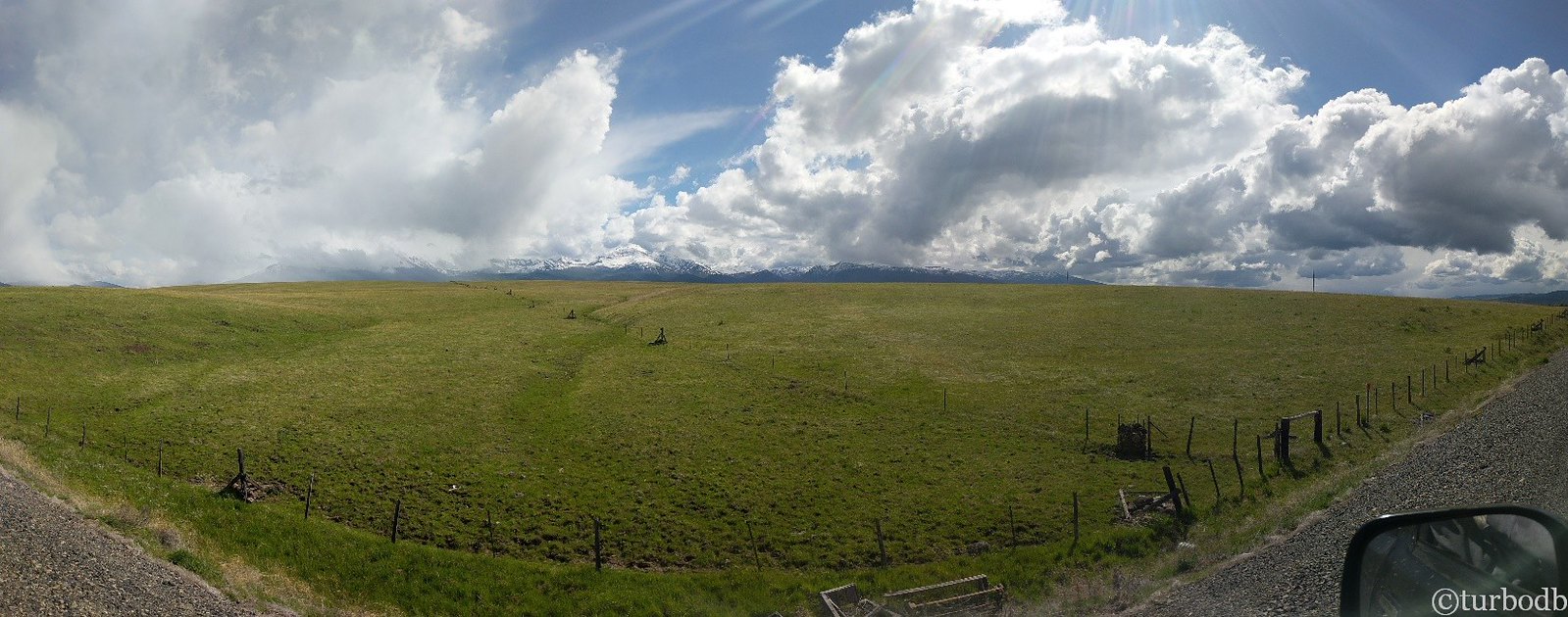
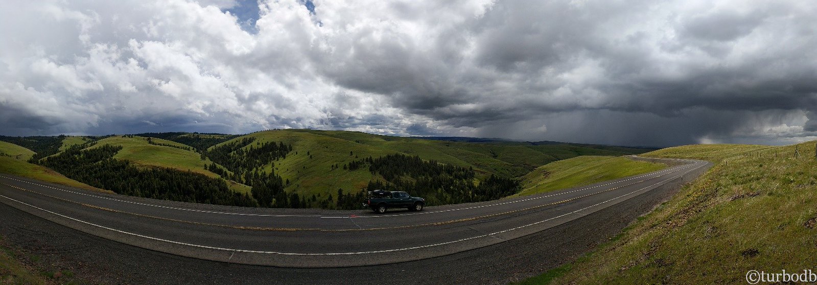
So we spooled the rope back onto the winch, and headed around. Back on the OBDR after about an hour, we considered driving to the other side of the Malheur Ford to wave to the guys in the other Tacoma, but decided to keep moving, except for a few photos as we re-entered and of sunset - it was nearly 8:00pm.
(above: note the interesting "change in exposure" in the middle of the panorama taken by my phone)
With the sun set and light quickly fading, we looked for a spot to camp as we drove up National Forest Development Road 1450.
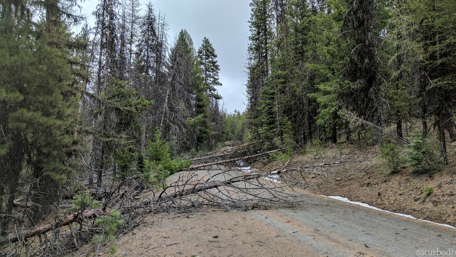
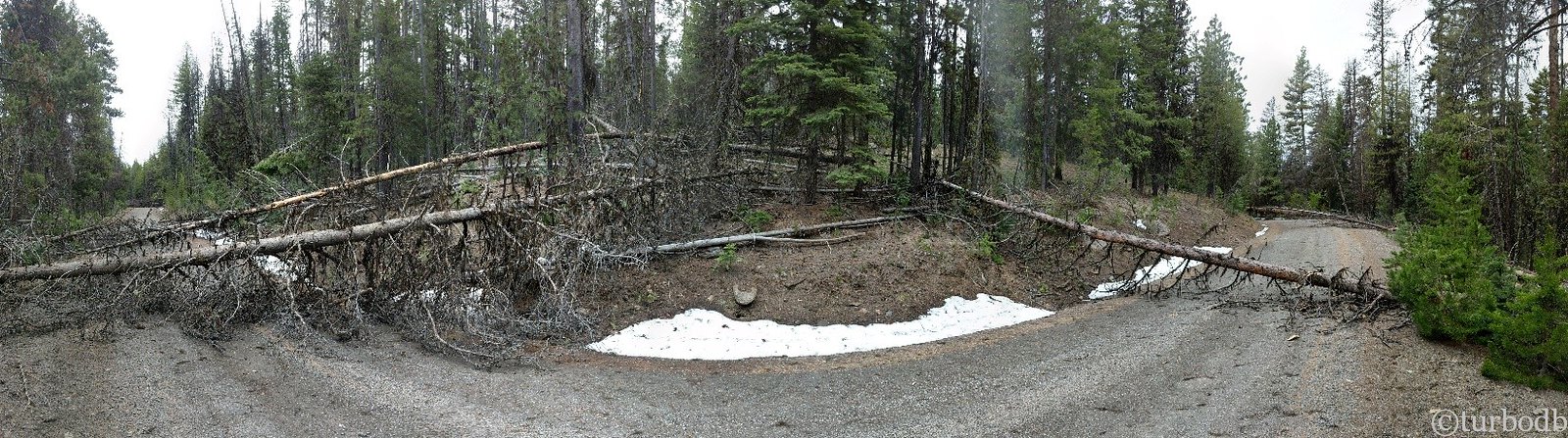
Instead, we found trees over the road.
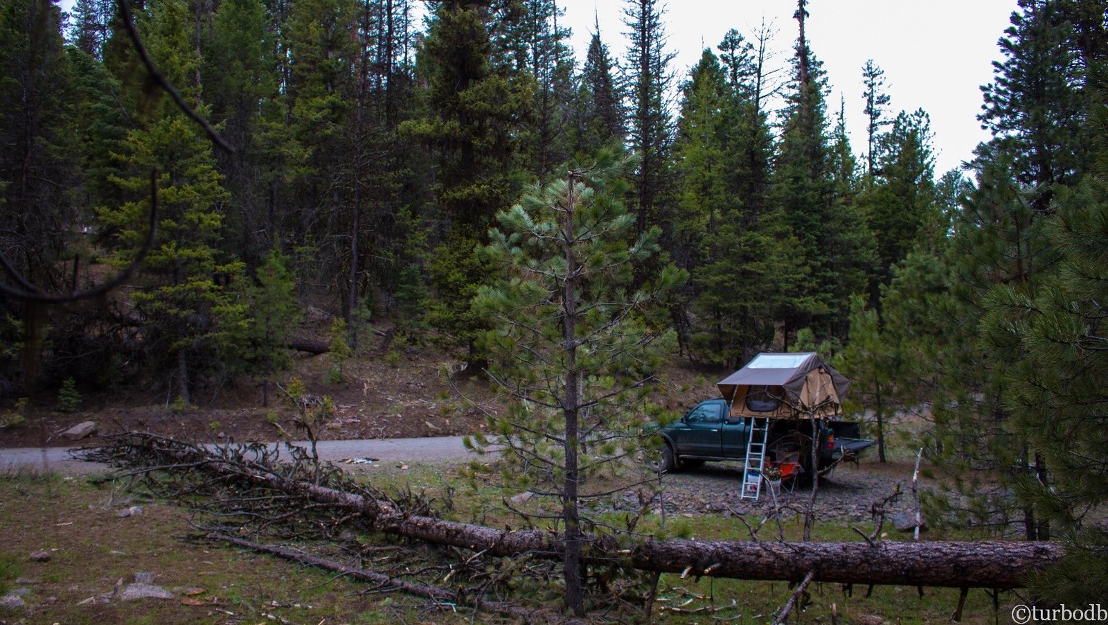
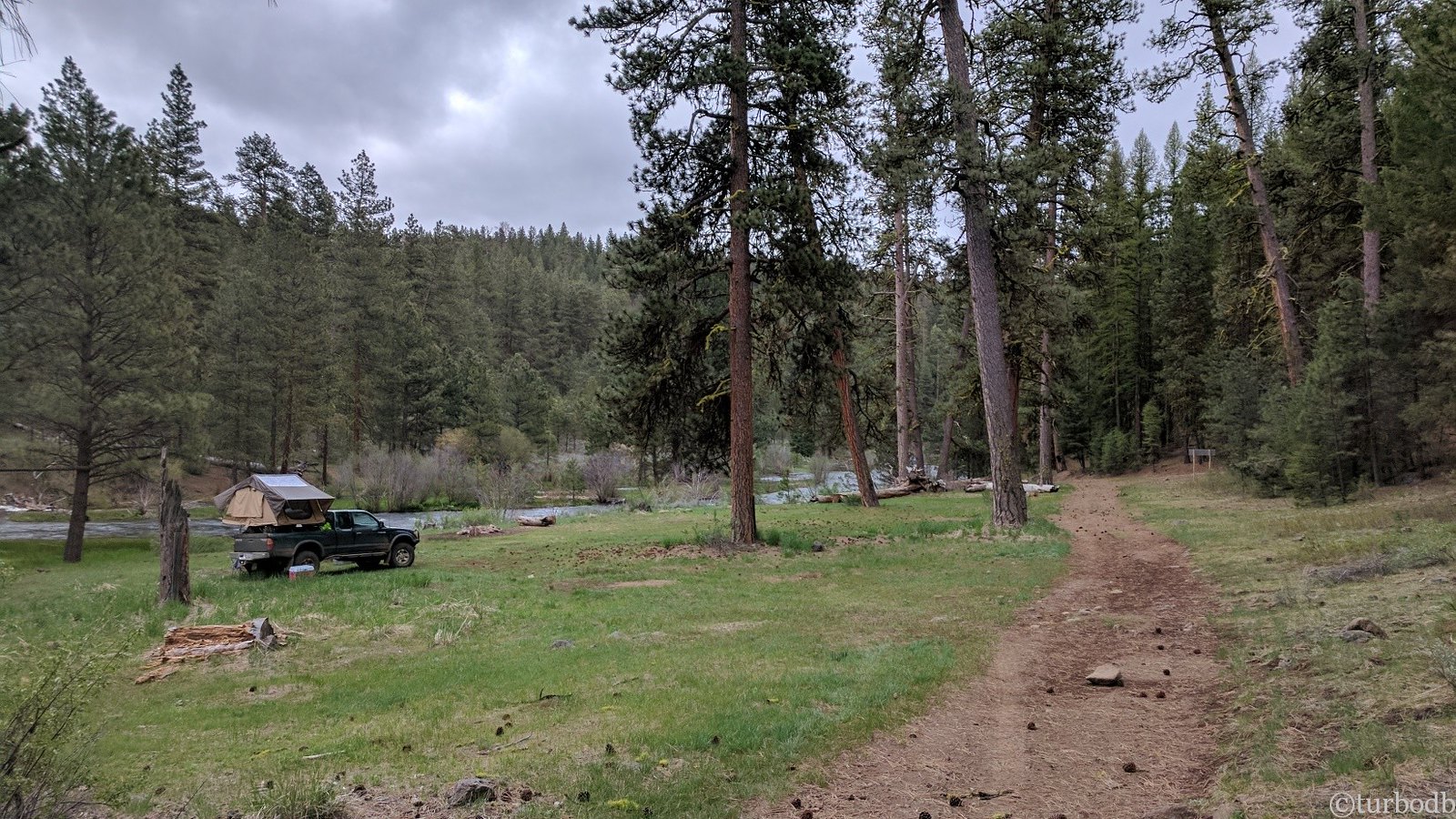
No stranger to trees at this point (we'd cleared six so far), we cleared two more to get to a nice little flat spot between the road and a creek.
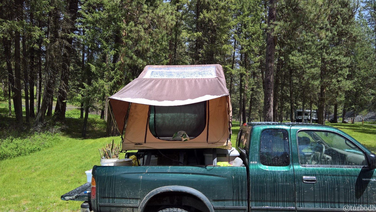
There, we levelled the truck, setup camp, and @mrs.turbodb got started on dinner (steak tacos) and I built a fire in the road - using limbs from the next downed tree that we camped next to, and hadn't cleared yet.
The tacos hit the spot; we warmed ourselves by the fire; and then we climbed into bed, exhausted.
We'd made it 17 miles. Not quite the 60+ miles we'd planned or the 250 we needed if we were to make it home in four days. Hopefully we'd be able to make it up tomorrow.
- - -
stats for day 1
- - -
Trees cleared: 8
Elk seen: 8
Rivers not forded: 2
Antelope: 1
Deer: 12
Moles: 1
Day 2: Friday, May 12.
I woke up early the next morning to see that we couldn't have done much better with camp. Having stopped just after clearing two trees, and before a third, I figured that any trees I could clear before @mrs.turbodb got up would get us going that much quicker and we'd make it that much farther - right?
By 7:15am, I'd cleared six trees on the next mile of road; I didn't see any more as I looked up around the next two bends, so headed back to camp for breakfast, just as @mrs.turbodb was getting up.
With six trees in the first mile, I should have realized that we were in for a long day. Instead, we enjoyed our breakfast and started packing up camp - ready to make great time!
Just as we finished zipping up the tent and putting the cooler back in the bed, it started to snow. No problem for us - we were off, and ready to travel a couple hundred miles - maybe even into Washington today!
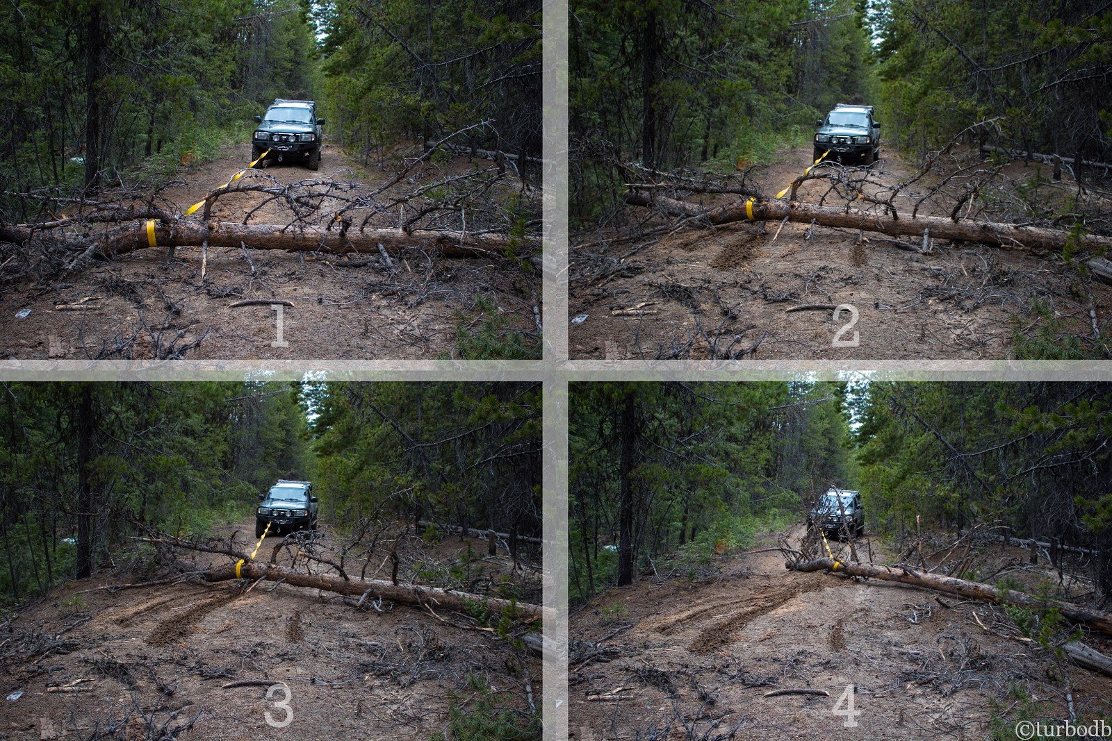
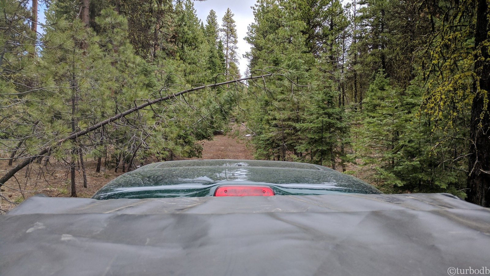
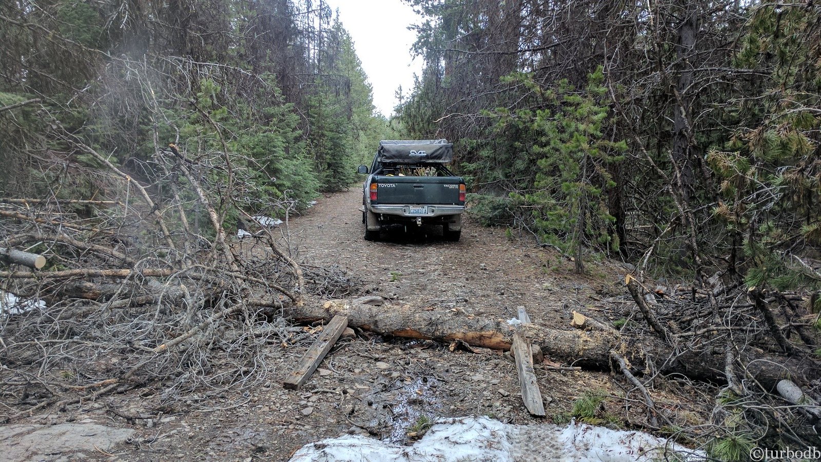
After about a mile and a quarter, we hit tree number seven. It was reasonably sized, so I cut off a few branches, the top (it was a 4-way split top in this case) and then dragged it out of the way with the truck (now, a completely natural thing to do).
We continued on. For several hundred feet. And then, we ran into a tree that was going to be a problem. It was 2 feet in diameter at the base, and was wedged between two trunks on one side of the road, and several trees and rocks on the other. Since it hadn’t split when it fell, that mean that I couldn't drag it with the truck.
We discussed.
We decided that the best bet was to walk a bit further up the road to further assess the situation. If this was the last tree for a while, it'd be worth figuring out a way to move it.
Around the next bend…
We discussed some more. We looked at the GPS. We found an alternate route.
@mrs.turbodb figured that clearing the trees would take about three hours - getting us another mile (for a total of three) by lunch time. So, we decided to try the alternate route.
Soon, we wondered if we'd made the right decision.
We cleared tree after tree. They were all smaller and movable (either by hand or truck) except for one. But it was laying on the ground, so we cleared branches and built a makeshift ramp (rocks and fence posts) up and over.
Finally, around noon, we completed the 3-mile long alternate route back to the main road. That's right - exactly where @mrs.turbodb had predicted we'd be (at noon) if we'd cleared the trees on the main route.
We were so winning. If by winning, one means going even slower than the previous day.
And it was getting on lunch time - so after clearing one more tree (by climbing it to cut the top off and make enough room on one side of the road), we found a little spot to pull over and enjoy some sandwiches and chips!
It was during lunch that our goals for the trip changed.
The new goal: Cut the trip short by 940 miles and try to get to Unity by Saturday.
Boy, were we still setting our sights high.
The day had been a mix of sun breaks and snow/hail, and we finished up lunch (in the sun) just as it started hailing hard enough that the hail stuck on the ground. We travelled another hour or so (on three roads) - passing a beautiful little spring named "Alder Spring" - before hitting the next downed tree.
It was at this point that I could tell @mrs.turbodb was kind of done. We'd cleared 24 trees since waking up, and that wasn't really her idea of a great time. I didn't mind so much - I mean, you're either driving or you're clearing trees - and either way, you're out in the wild - but I was starting to get worried about fuel. I knew that we had plenty to get back to civilization now, but if we got nearly to Unity and then hit an impass, I wasn't sure if we'd have enough to back-track the entire way (even with four extra gallons in the RotoPax).
Without clearing the tree, we decided to drive out and head in to Prairie City, 35 miles away - just to the north of a spring-green Prairie and Strawberry Mountain.
In Prairie City we filled up with gas, and decided that we'd give it one more shot - afterall, even though we were making slow progress, we didn't really have anywhere to be, and we were definitely making the route better for those who followed.
"I've got an idea," said @mrs.turbodb. "Let's head back a different way. We can take FS-13 (we took FS-16 into town) and join back up with FS-16 just before we hit the OBDR turn off."
So we did.
FS-13 was a hill climb. On the way up, we passed a National Forest sign proclaiming the awesomeness of the thinning operation that had taken place a few years earlier - from 5000 trees per acre to 180. Wow, that's a lot of thinning. When we got to the pass, we saw two things:
1. A huge pile of trees on a "logging platform" - which we assumed were from all of the thinning.
2. The end of the road. At least, the end of the plowing of the road. The pass down to FS-16 was snow covered and impassable.
Yep, that's how our luck was panning out on this trip.
We headed back down the way we came and finally - three hours after we'd tracked out - we were back at our 25th tree of the day. We cleared it easily and continued on.
Little did we know, it was to be our last tree. But, that didn't mean that we were home free. Far from it.
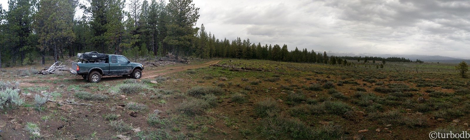
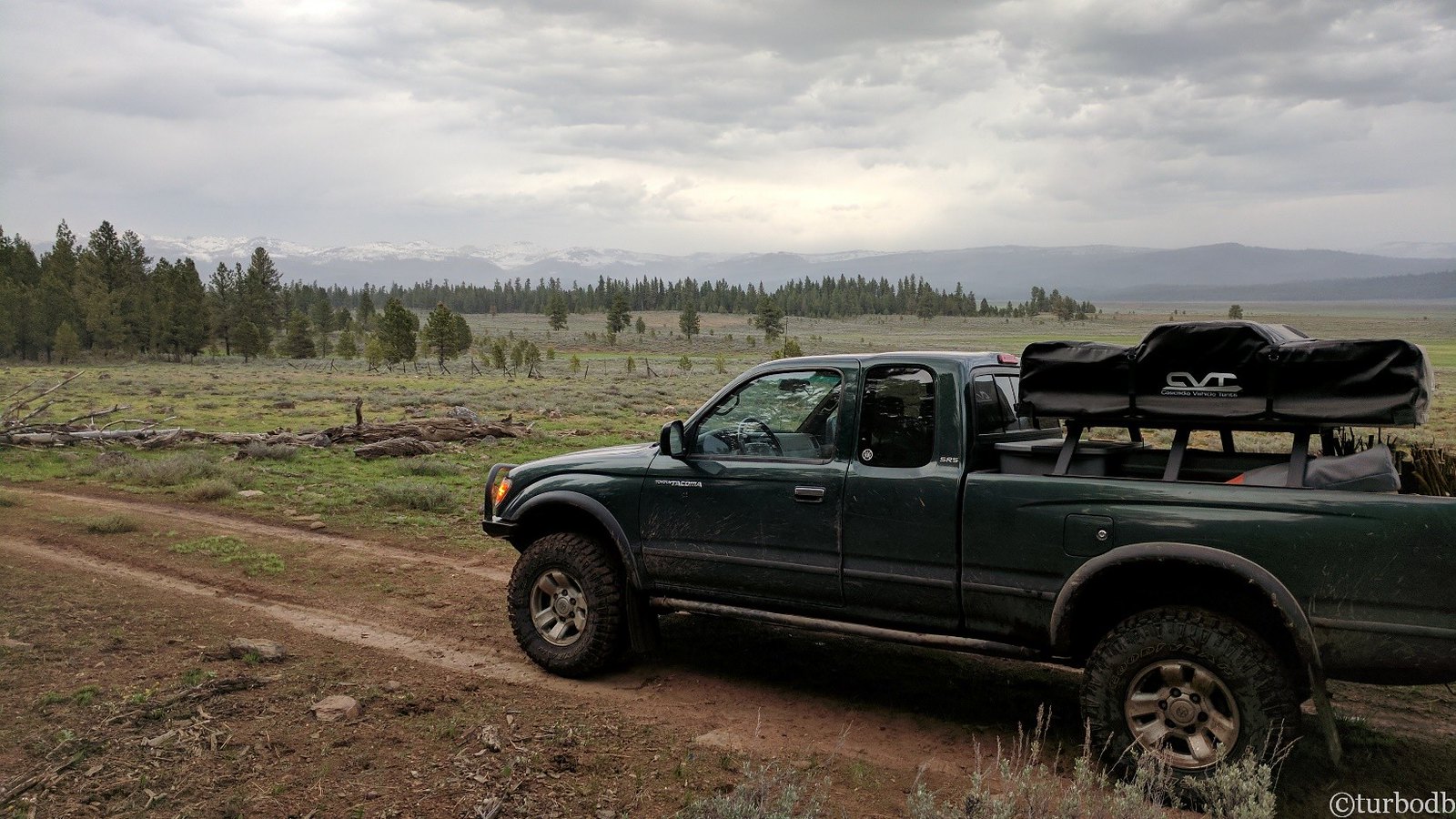
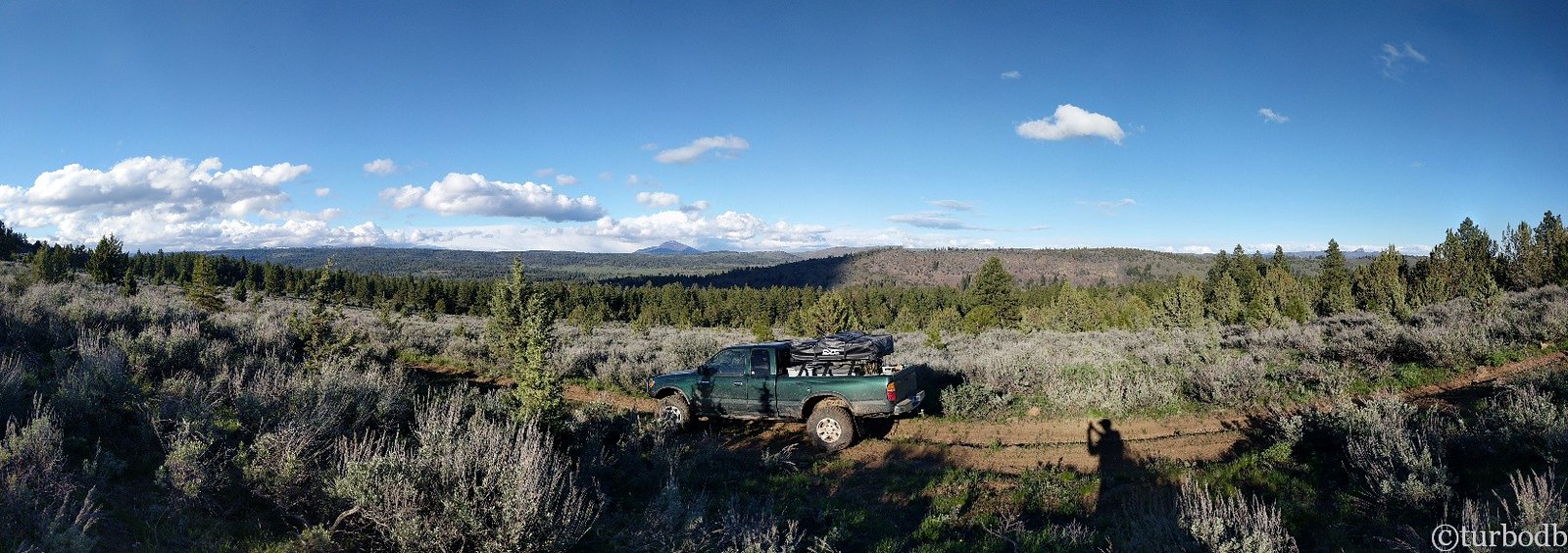
As the miles ticked away, we were increasingly excited. "Can you believe it?" I said, "30 minutes without a tree." As we traversed hillside after hillside, we finally came around to the east side of the range, and the blue sky opened up in front of us - clouds and snow captured to the west.
In the distance, Ironside Mountain, just south of Unity. We weren't likely to make it today, but maybe we'd still make it!
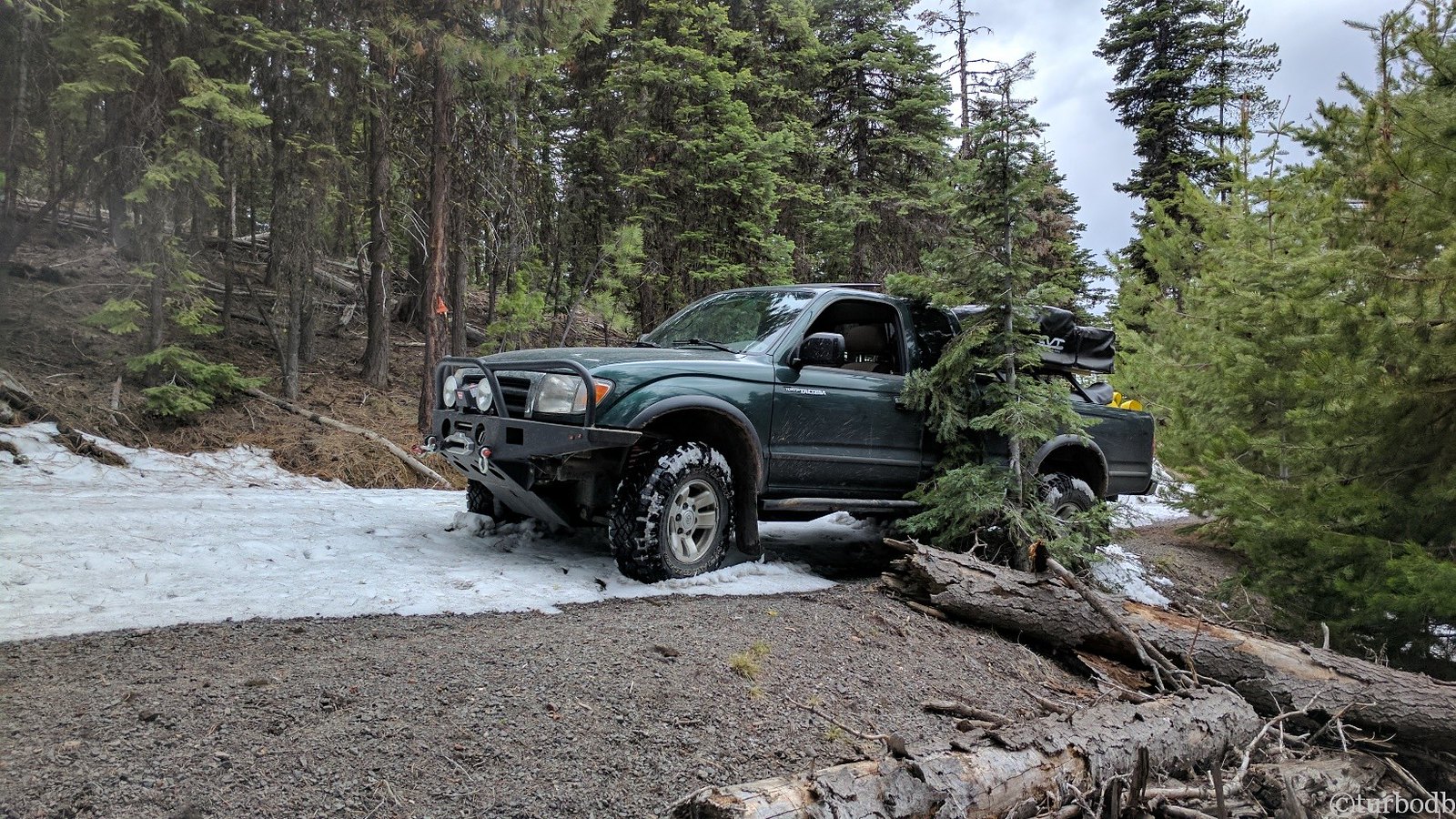
And then, we started heading down. We hit a couple of rocky patches in the road and bumped the skids a couple times as we dropped down off of some of the larger rocks. Boy, was I glad to have those. And, we hit a couple of muddy patches, where it was nice to be aired down and in 4-low.
All the time, no trees!
And then I saw it, around the next corner. A river. A big river. The North Fork of the Malheur River.
We'd arrived here almost exactly 24 hours after I'd waded across our first river the day before. And it was immediately clear that there was no need to wade across this one. It was deeper, the water was faster.
We were stuck.
We looked at the map and GPS for a go-around.
Nothing.
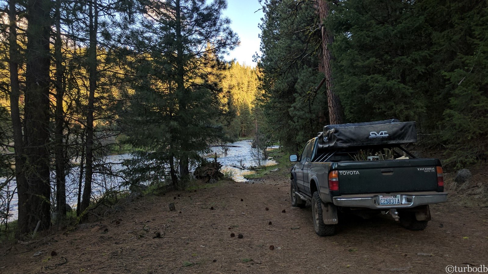
And so, we decided to set up camp on the east side of the North Fork of the Malheur River (Crane Creek Camp?) and call it a night. We were pooped.
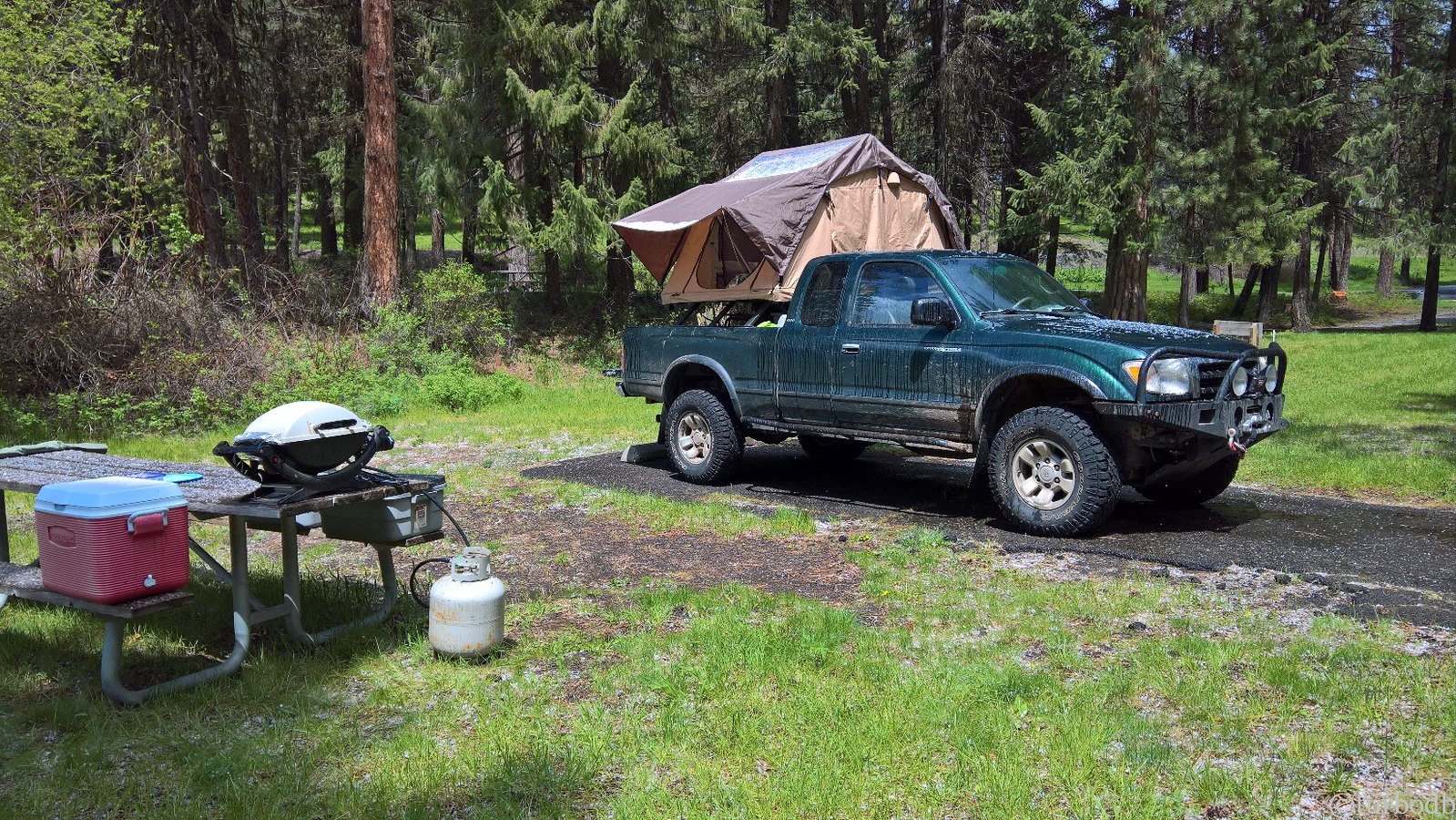
We setup the tent and got ready for dinner. Out of our gourmet meals for the trip, dinner was grilled hot dogs and corn - and to us, that was great. Gourmet even.
A huge camp fire rounded out the evening and we hit the sack as darkness fell, unsure of our plans for the next day, but definitely not expecting what was to come.
- - -
stats for day 2
- - -
Trees cleared: 25
Trees cleared before 7am: 6
Elk seen: 4
Rivers not forded: 1
Day 3: Saturday, May 13.
When we woke at 7:10am, it was cold. The clear blue skies of the day before had given way to clouds. Before getting up to eat our cereal, we decided that today we'd make our way out of the forest. With no good go-arounds to Unity, we were done with the OBDR - for this trip.
We'd head back out and then up to the Columbia River Gorge, where we planned to camp for the evening. But of course, we're getting ahead of ourselves again.
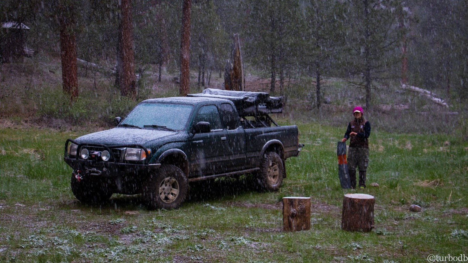
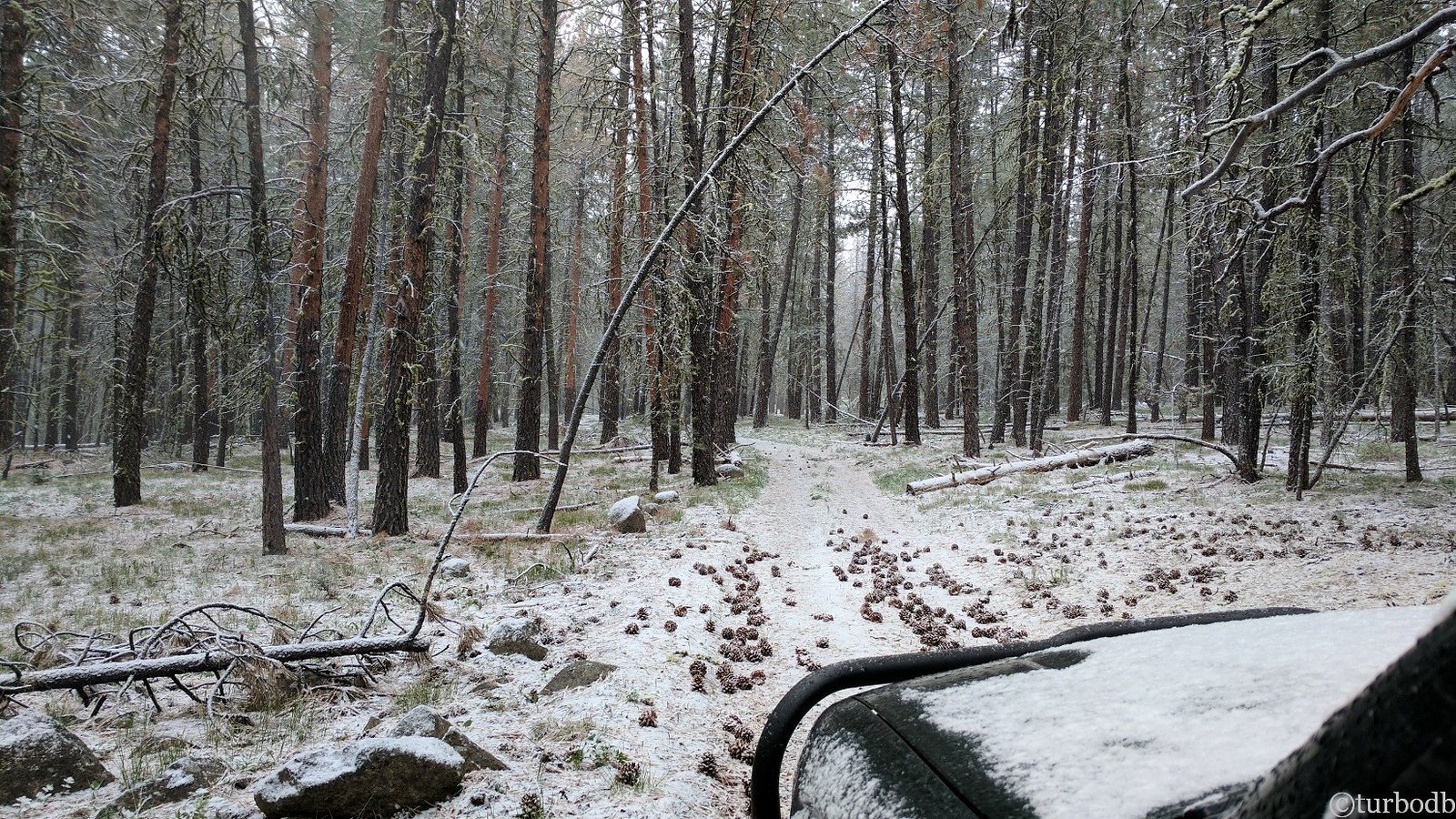
As we ate breakfast, it started snowing. That, along with the cold temps meant that the snow was sticking, and we started high-tailing the packing. By the time we were hopping in the truck, there was a good inch on the ground and heavy snowfall.
No wonder we didn't notice that @mrs.turbodb hadn't fully closed the tailgate.
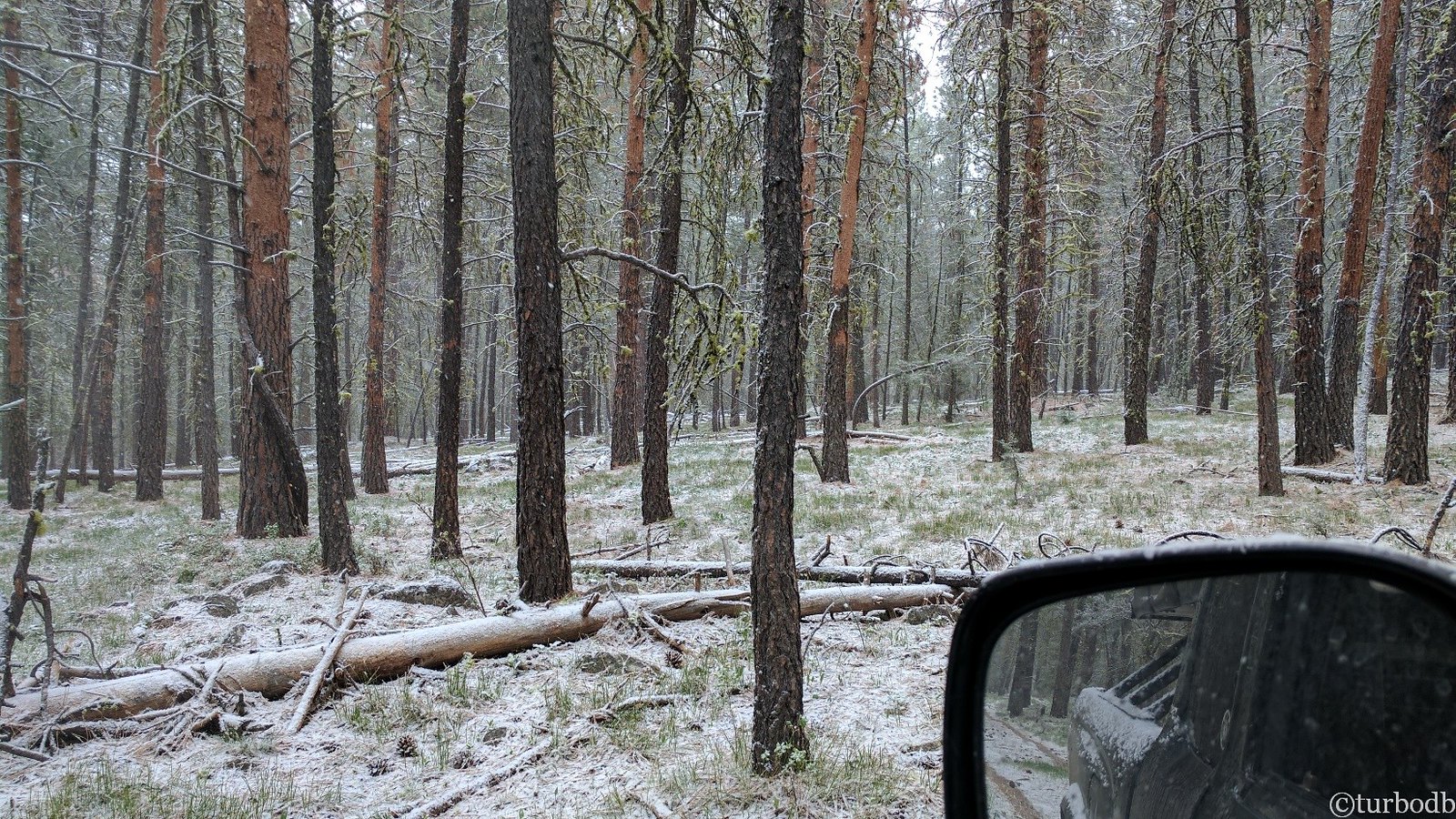
As we drove up and out, snow depth increased - it'd been snowing here longer than at the river ford. We stopped to take pictures, we climbed up through the muddy sections, and we made it through the rocky areas without an issue.
And then, I noticed the tow strap hanging out the back.
"Is the tailgate open?" I asked.
Later, when telling the story to co-workers, one of them would ask @mrs.turbodb, "Oh no, did he swear?" (because usually I'm pretty chill)
Oh yes, I swore.
You see, we'd driven a hairy couple of miles even without snow and ice. Fresh snow makes that a bit worse, and compacted snow turns the situation into an icy one.
We'd lost a lot of stuff out the back - a RotoPax, three buckets (firewood), a 5gal propane tank, our Weber grill, and the box we keep our shoes in at night. It was time to go back. Back to the very beginning, where 100 feet from camp, as we started the climb out, the first item had dropped off the back of the truck.
So yep, there was some swearing. And not a whole lot of talking for the next hour as we drove through the snow on our way back to Prairie City, where we'd bee-line it to Washington.
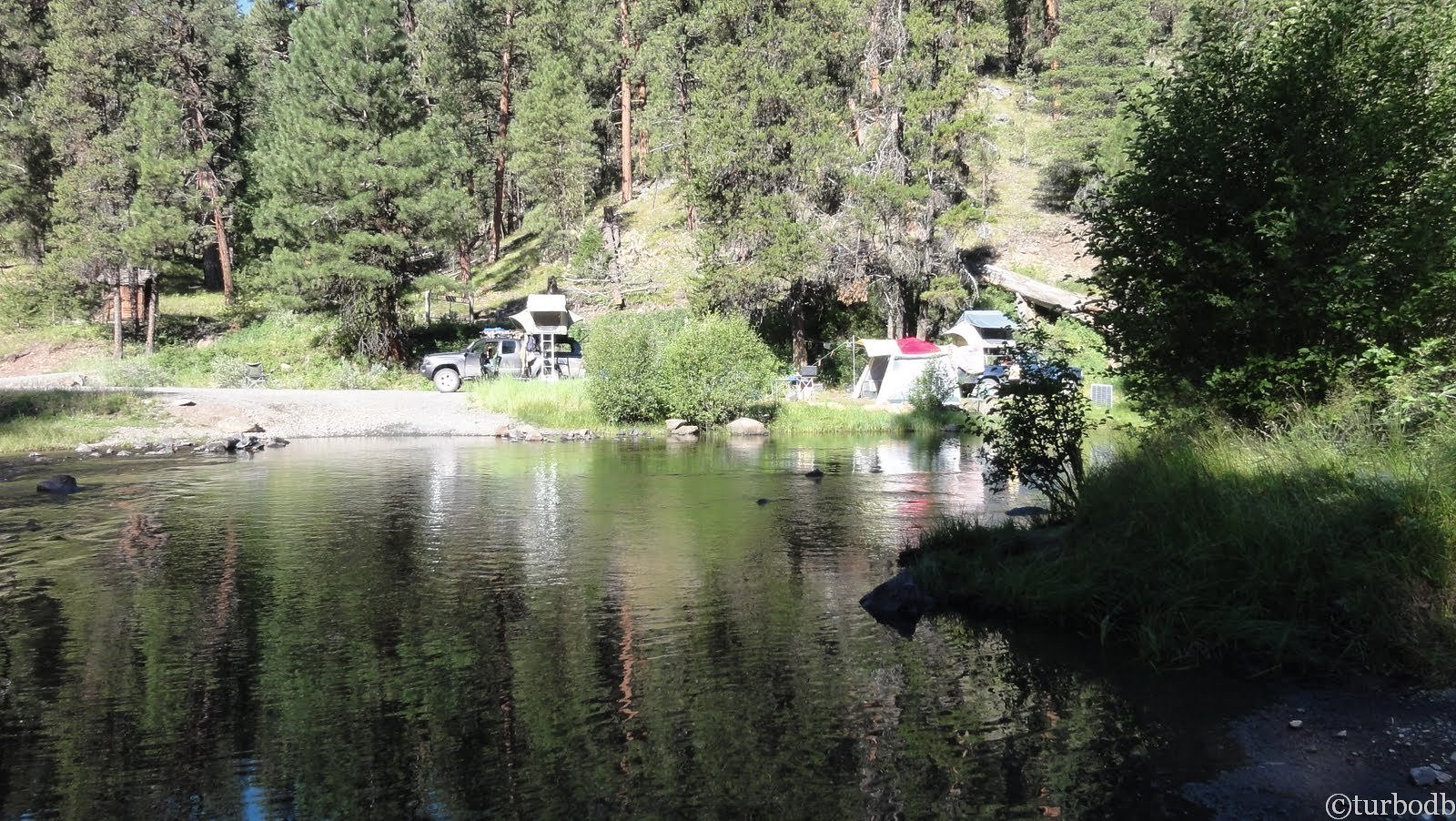
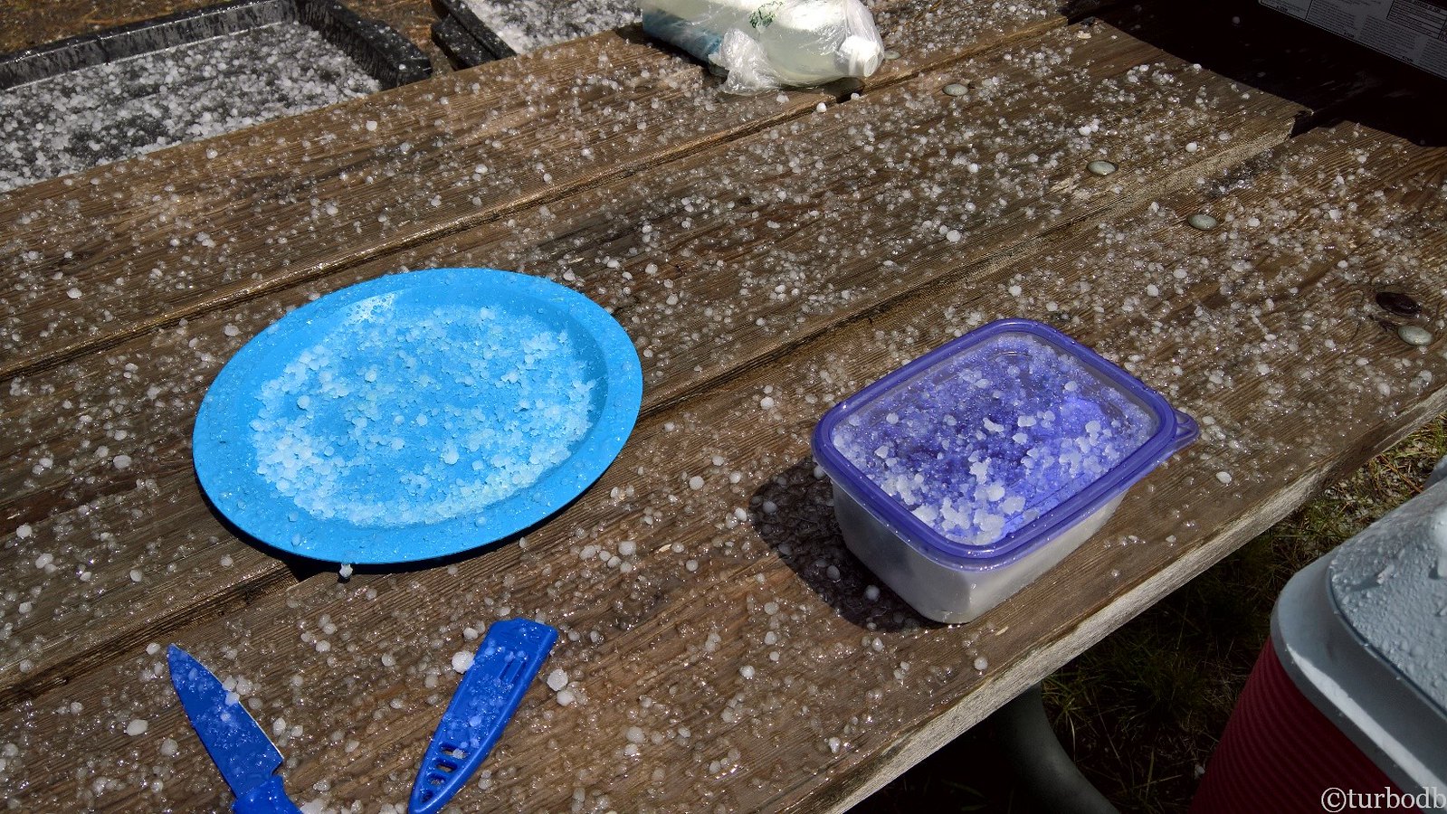
As time passed though, the conversation started back up again and we started making plans for lunch and for camp that night. We decided to do lunch on the road - we had a bit of lunch meat, some grilled chicken, and our last avocado to eat, and so between snow and hail showers, we pulled over at an empty (except for the camp host) campground.
Since we'd put the tent away wet (in the snow) I decided that this break in the weather was a great time to dry it off, so I opened it up and got it airing out.
It dried in the sun for a good 7 or 8 minutes before it started to hail. Hard.
@mrs.turbodb suggested that I sweep off the top of the tent once the hail stopped and the sun came back out, which I did. We let it dry for 15 minutes or so this time, when we saw another snow flurry coming. We packed it up again, still quite wet and decided that we'd just dry it out when we got to the Columbia River Gorge (now our next destination) since it was supposed to be 70 and sunny) and setup camp for the night.
The remaining drive out of Oregon was beautiful.
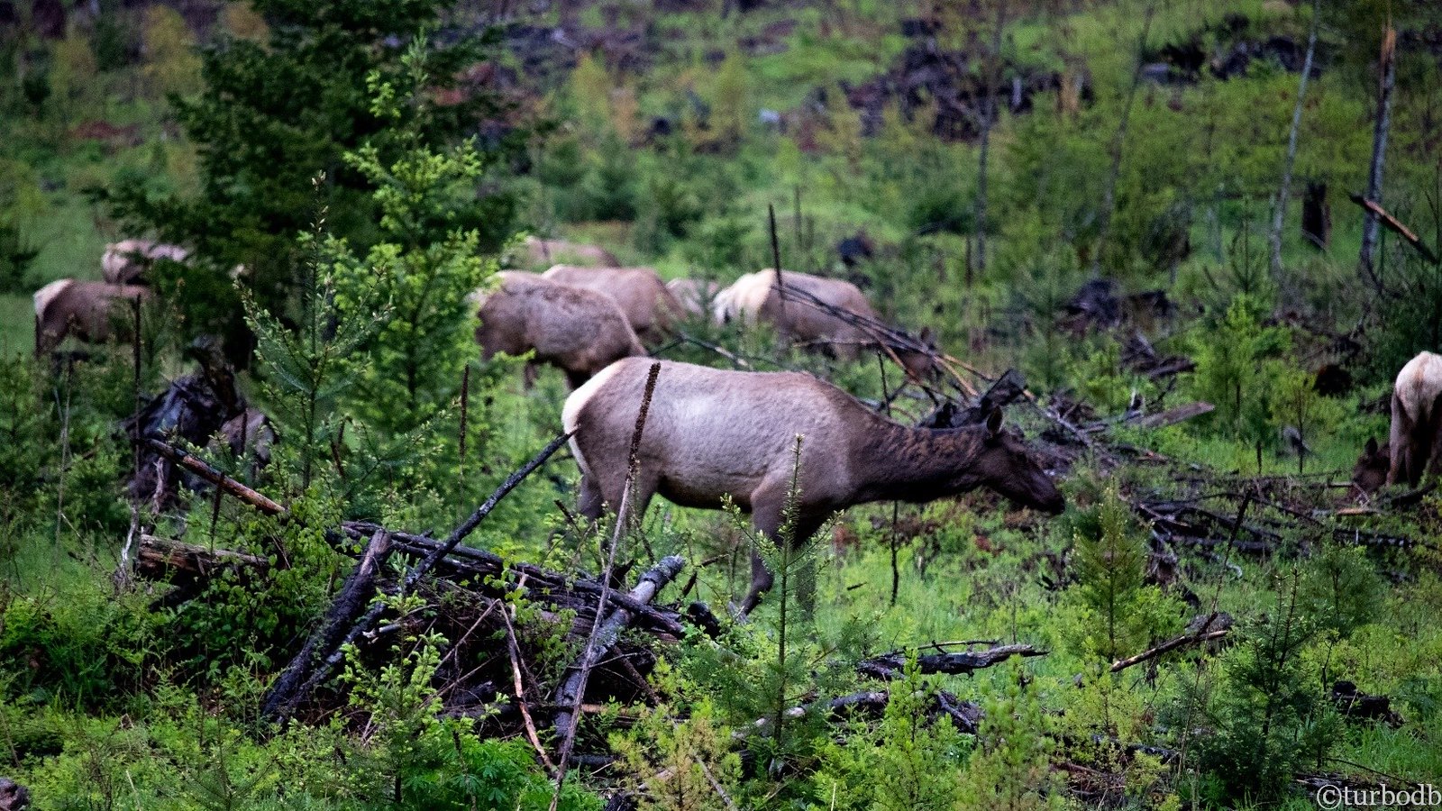
The whole time we drove in and out of sun, snow, hail, and rain, until we hit The Dalles, where we crossed into Washington and started looking for a place to camp. Spotting a FS road into the mountains we headed up, where within a few miles we came across a herd of 50 Elk grazing in a clearcut.
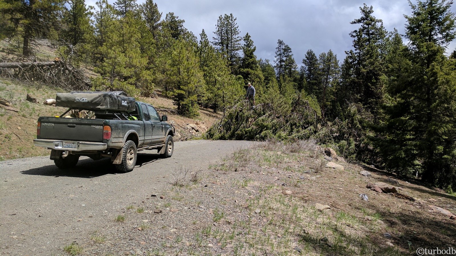
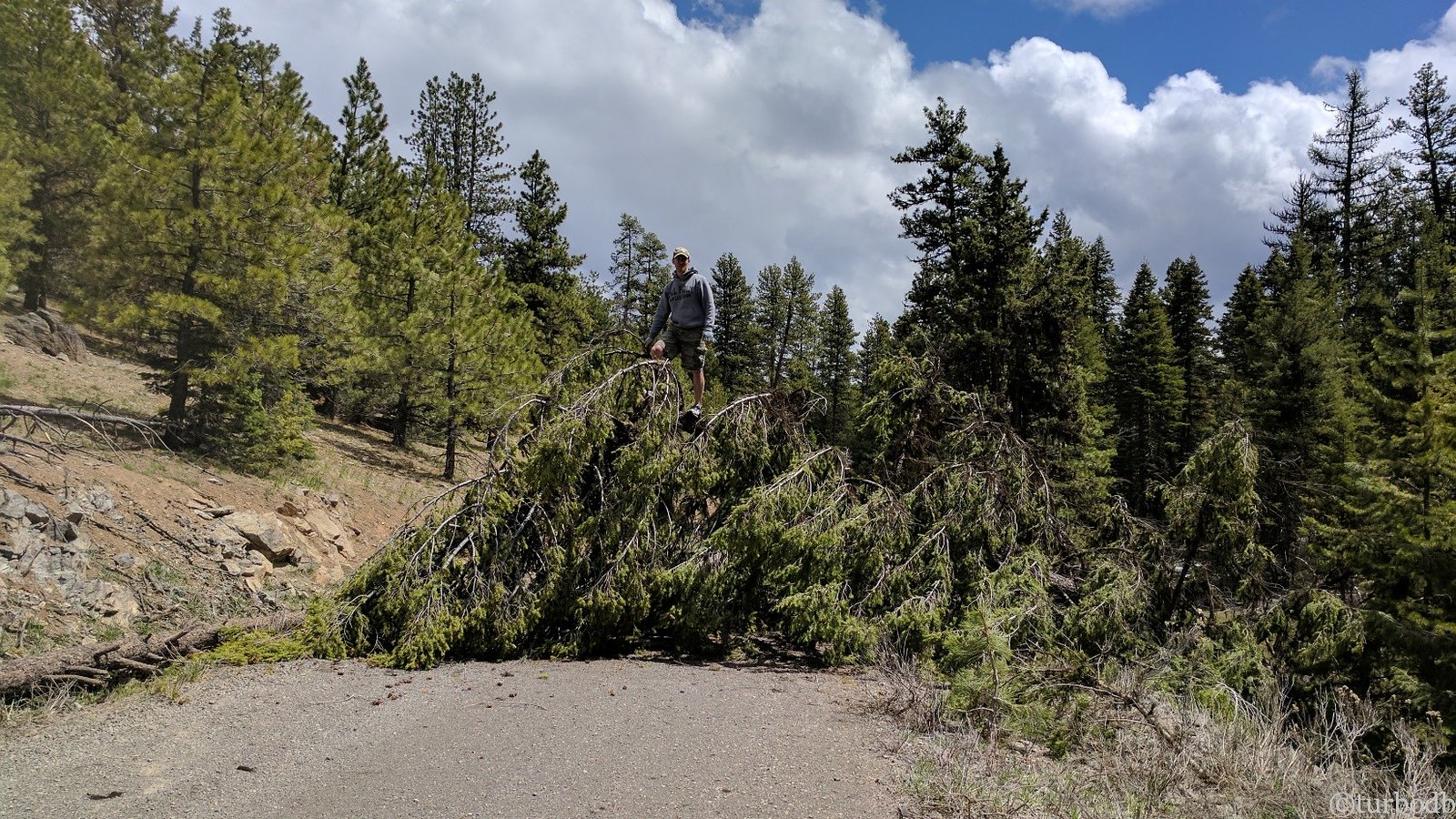
We continued on (up) as the sky darkened. Though the road we were on was paved, it was clear that it was lightly travelled. Lucky for us, the trees down on the road had been cleared just enough (by someone like us) to drive around them.
We hoped that would hold to our destination - Summit Camp - just 2½ miles further up the road at this point.
It held for one mile. Then a mile and a half.
It held till mile two, where the road was completely covered in snow about 18 inches deep.
It was at this point that we finally realized that we should just head home. It'd be another four hours of driving, and we'd have to air out the tent the next day, but at least we'd get to sleep in our cozy bed and take a shower (it'd been a full week at this point since our last shower) when we got up in the morning. And we'd get to go to Whidbey for Mother's Day.
So that's what we did.
We got home at 1am. It'd been a long day of driving, and a trip (really three) to remember. And we'd be back.
- - -
stats for day 3
- - -
Trees cleared: 0
Elk seen: 50
Attempts to dry tent: 3
Hours driving: 16-ish